

Sigeric’s Itinerary (990 AD): Re-evaluating Stage LXXX (Sumeran)
For decades, modern mapping of the Via Francigena has followed Philip Grierson’s 1940 identification (building on William Stubbs’ 1874 footnote) of Stage LXXX (Sumeran) as the village of Sombres near Wissant. Examining the raw 10th-century logistics, road infrastructure, and manuscript paleography reveals a compelling alternative: that Sigeric stayed on the straight Roman highway to Sangatte.
1. La Leulène Road Geometry & Grierson’s Contradiction
- The Straight Vector: The paved Roman ridge road (La Leulène) runs from Thérouanne through Guînes (Stage LXXVIII, Gisne) and continues straight northwest directly to the coast at Sangatte (the ancient cliff-ramp harbor of Sclives).
- The Internal Contradiction: On page 68 of his 1940 paper, Grierson explicitly acknowledges that the Roman highway ran from Thérouanne to Sangatte via Guînes. Yet on page 67, he invents an undocumented cross-country detour to pull Sigeric away from paved infrastructure and across unpaved chalk hills toward Sombres.
- Logistical Reality: For an elite diplomatic caravan with pack animals and baggage wagons, abandoning a straight, stone-paved highway just miles from its coastal terminus makes little practical sense without an acute crisis.
2. Stage LXXIX (Blank): The Coastal Encampment
- The Distance Imbalance: The march from Thérouanne (LXXVII) to Guînes (LXXVIII) covers roughly 45–50 km. By contrast, the final stretch from Guînes to the coast at Sangatte is only ~16 km—an easy half-day march.
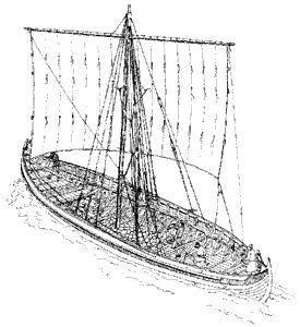
- Waiting for the Tide: 10th-century Channel crossings did not run on fixed schedules. Rather than marking an extra day of marching to Sombres, the blank Stage LXXIX likely represents an open-air coastal encampment near the road’s end while the retinue waited for a merchant vessel (ceol or knarr) to arrive, unload, and catch a favorable tide and wind.
3. Paleography: The sæ-mæran Handwriting Slip
- Descriptive Vernacular: The Canterbury scribe routinely used Old English geographical terms for final stages (e.g., Teranburh, Martinwaeth). In Old English, sæ-mære means ‘sea-boundary’ or ‘sea-edge,’ and its location form sæ-mæran means ‘at the sea-boundary.’
- Copyist Transcription Error: Cotton MS Tiberius B.V is an 11th-century copy made decades after 990 AD by a scribe prone to spelling errors. In Anglo-Saxon minuscule script, a faded or cramped ‘æ’ (ash) easily loses its crossbar and looks identical to ‘u’—turning sæ-mæran (‘at the sea-edge’) directly into Sumeran.
- Preserving the ‘Sce’ Rule: Because the scribe always prefixed saints’ names with ‘Sce’ (Sancte), treating Sumeran as a secular topographical description (‘the sea-edge’ at the end of La Leulène) avoids violating the manuscript’s formatting rules.
| Attribute | Standard Consensus (Sombres / Wissant) | Alternative Model (Sangatte / La Leulène) |
| Road Infrastructure | Requires leaving paved Roman road for unpaved hills. | Follows straight paved La Leulène directly to the coast. |
| Stage LXXIX (Blank) | Assumed to cover extra detour distance to Sombres. | Explained as a coastal waiting camp for ship, tide, and wind. |
| Meaning of ‘Sumeran’ | 1940 philological guess linking to 1337 ‘Sombrenes’. | Copyist misreading of Old English sæ-mæran (‘at the sea-edge’). |
Leave a Reply
You must be logged in to post a comment.